

Administrative information
UFA 10-064 is located in Moloundou Arrondissement, Boumba and Ngoko Département, East Province, Republic of Cameroon (Figure 1). It was allocated to the company FILIÈRE BOIS (FB) by Temporary Logging Agreement no. 0835\CPE\MINEF\CAB dated 4 October 2001.
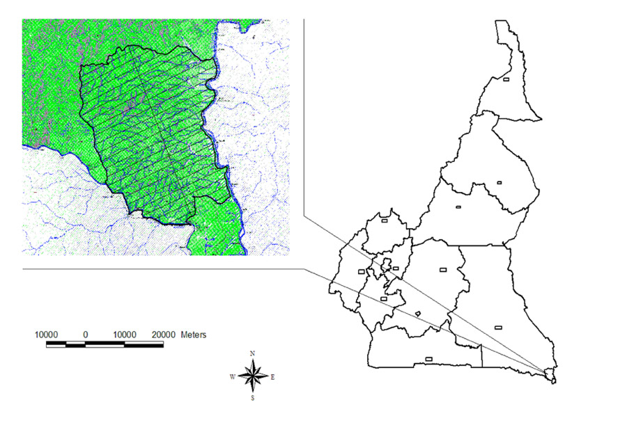
Figure 1 – Map showing location of UFA 10-064
Definition of boundaries and geographical location
UFA 10-064 covers an area of 115,900 hectares according to the Area Measurement Certificate drawn up by the Boumba and Ngoko Département Land Registry Office in Yokadouma. The report describing the boundaries on a map using Arview mapping software gives an area of 115,842 ha.
UFA no. 10-064 is shown on the Moloundou 1:200,000 map, sheet NA-33-XVI. It lies between latitudes 1°46 and 2°59 North and longitudes 15°46 and 16°58 East.
It belongs to the south-east Technical and Operational Unit (UTO).
This UFA is bounded:
- to the north by Lobéké National Park;
- to the east by the River Sangha, which forms a natural boundary between Cameroon and the Congo;
- to the south by the River Ngoko which forms a boundary between Cameroon and the Congo;
- to the west by UFA 10-063.
The boundaries of UFA 10-064, as described in the Area Measurement Certificate, are shown in Figure 2.
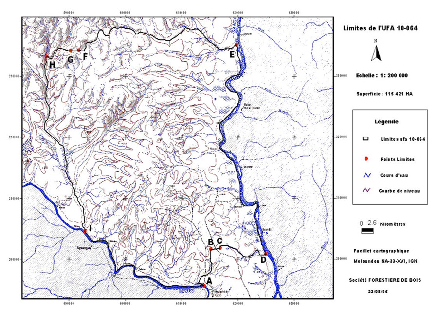
Figure 2 – Boundaries of UFA 10-064
Ecological factors
Topography
UFA 10-064 is located on the north-west side of the Congo basin. Its landform is relatively flat, with a few hills. Its altitude ranges between 400 and 520 metres. The altitude decreases from north to south.
Pedology
The area of UFA 10-064 consists of metamorphic formations from the Precambrian to Cambrian eras belonging to the lower Dja series, mainly consisting of tillites, quartzites, shale, limestone and dolerite.
In the low-laying areas, these geological formations are covered with alluvium dating from the quaternary era.
The soils are hardened and covered in places by ferruginous duricrust. They are lateritic soils deriving from ancient metamorphic rocks. They are acid and clayey, with a low content of nitrogen and exchangeable bases. Their humus layer is relatively thin. Hydromorphic soils are also found in some places.
Hydrography
In hydrographic terms, UFA 10-064 belongs to the Congo Basin. Its hydrographic network is relatively dense. It is watered by the tributaries of the Sangha and Ngoko rivers. The main watercourses are the Bolou, Mikongo, Moboussamba and Mokoto to the west of the UFA, Ngoko to the south, Moko-paka, Ndjoke, Kimou, Bolima, Nadimaguina and Ndjangue to the north, and the River Sangha to the east.
These rivers form complexes of floodable and marshy forests, the main ones being situated along the River Sangha.
The hydrological regime of the watercourses is closely linked to the rainfall pattern. The maximum water levels are observed from October to November, and the minimum levels from January to February.